Mapping Miami-Dade: Local Focus Area

The IDEAS Consortium's I2A Learning Community has identified neighborhoods reflecting the demographic priorities of our three lead community organizations. The neighborhood-level maps below were developed with the advisement of community leaders to focus on the assets and needs of children in each community, and to ensure that data collected and findings are culturally informed and appropriatly contextualized.


Countywide map with focus areas

Open All Tabs
  • Countywide map with focus areas

    The countywide map below shows all areas of focus as defined by our community partners.

    • The areas in purple were identified by Sant La Haitian Neighborhood Center to include a focus on the Haitian population. 
    • The areas in yellow were identified by ConnectFamilias to include a focus on the Hispanic population. 
    • The areas in teal were identfied by the Overtown Children and Youth Coalition to include a focuss on the Black population. 

The Northeast Corridor (Sant La)

Open All Tabs
  • Community boundaries of the Northeast Corridor


    The Northeast Corridor  is one of the neighborhood focus areas for the Together for Children coalition.  It includes Little Haiti and surrounding areas with notable Haitian immigrant populations.   The neighborhood boundaries and zip codes shown in purple were selected by Sant La Haitian Neighborhood Center for inclusion in the Northeast Corridor catchment area.    


    NEC Area


  • Interactive website for parents seeking early learning resources (beta)

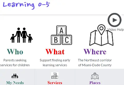
    Map to Learning 0-5  is an interactive webpage designed to help families in the Northeast Corridor find local childcare centers and early learning resources that fit their needs. Services from multiple provider systems, including data partners in the IDEAS Consortium, are integrated into one collaboratively designed resource. 
    The website is available in English, Spanish, and Creole, with user-friendly videos throughout to help guide parents as they navigate the resource locator.  The project is now in its beta testing phase under the lead of Sant La.  
    parent website graphic

Overtown and surrounding areas (OCYC)

Open All Tabs
  • Community boundaries of Overtown and surrounding areas

    Historic Overtown was officially designated as a neighborhood for black Americans at the incorporation of Miami in 1896.  The neighborhood boundaries and zip codes shown in teal were selected by the Overtown Children and Youth Coalition (OCYC) for inclusion in the broader Overtown catchment area.   
    Overtown Area

Little Havana, Hialeah, and Westchester (ConnectFamilas)

Open All Tabs
  • Community boundaries of Little Havana

    Little Havana has been home to many Cuban exiles and immigrants from Central and South America since the 1960s.  It is one of three neighborhoods selected by ConnectFamilias to focus on Spanish-speaking immigrant populations, with the neighborhood boundaries and zip codes shown in yellow.   

    Little Havana area

  • Community boundaries of Hialeah

    Hialeah is notable for its high proportion of Hispanic Americans, including having the nation's highest concentration of Cuban and Cuban-American residents.  It is one of three neighborhoods selected by ConnectFamilias to focus on Spanish-speaking immigrant populations, with the neighborhood boundaries and zip codes shown in yellow.   


    Hialeah Area

  • Community boundaries of Westchester

    Westchester is notable for its high concentration of Hispanic and Spanish-speaking Americans.  It is one of three neighborhoods selected by ConnectFamilias to focus on Spanish-speaking immigrant populations, with the neighborhood boundaries and zip codes shown in yellow. 
    .

    Westchester Area

Top